Heading down the gravel road back to Morice Lake Road I
see a black bear, still far enough away from the camp, also a high glacier
caped mountain to the north and a caribou.
Turning onto unnamed road towards Norelee, it hugs a
mountain edge and the Francois River. It
has quite a bit of up and down with quick turns often together, not so much fun
with loose gravel. Francois River
becomes a long lake, I’d say at least 80kms long, make me think it was created
by damming the river.
All along the lake
is a major hillbilly cottages country, few houses lots of mobile homes dragged
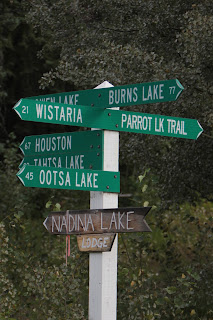
up beside the lake and RV’s converted to cottages. I connect onto Hwy 35 heading north to Burns
Lake and back onto hwy 46 East.
I go to Fort St. James hoping its’ better that Fort
Simpson in the Northwest Territories which also was the National Parks Canada
site. However Fort St. James is just
53km off the main road and it’s paved. Fort St James was the main HBC trading
post for the central region of Northern BC. Parks Canada has restored it to
1886 vintage and within each building is girl from Quebec taking about what’s
inside. For the kids they have turkey racing at 11:15am every day, eight
turkeys are lined up in a cage and are forced to run to the other side. Apparently they have been doing this for a
very long time and its very successful and even world famous.
At Prince George I manage to skip the town and get onto
97 south, passing Hixon about 60kms, the mountains give way to rolling hills a much
drier region, I see my first sage brush and the is scrubby pines on rocky
slopes, its cattle ranch country.
I check into the local tourist information and they are
all dressed up in vintage clothing to promote the main attraction near here
Barkerville (108km off the highway) a living museum circa 1898 the gold rush
year. Barkerville is a ghost town that
was brought back to life as a gold era theme park. I went to one of these in Wyoming a few years
ago, so passed on this one.
Getting off hwy 97 at Beaver Lake road, another gravel
road, but it cuts off close to 100km of distance to my targeted camp location
of Likely. Get to Likely and decide I
should do better, next option Horsefly.
Here too is a gravel road just 40km long that makes this side trip into
a loop. Here I found another error of
the Official BC Map; they have marked a logging or ATV road as the one to take
but the actual Likely to Horsefly road is 15km out of town not 1km. About 30kms down the road I come upon Roberts
Lake Recreation Area offering a free lake side campsite, firewood and pit
toilet and decide I can’t do any better.
Roberts Lake Recreational Park has a real northern
Ontario feel to it, no mountains in view, a pair of Loons in the middle and a
beaver swimming around in front of my site.
This beaver was active for much of the night, in the morning I looked
around and noticed it was working and a tree very close to where I was parked.
808km today


No comments:
Post a Comment